Hiking in Santorini Beyond the Fira–Oia Caldera Path
Are there hiking options in Santorini besides the Fira to Oia caldera path?
Yes. The stone stairway down to Ammoudi Bay below Oia, quiet lanes linking inland villages such as Pyrgos, Megalochori and Emporio, and the quieter caldera-rim corners around Imerovigli and Skaros Rock all reward walking. None of these have an official distance or duration published, so plan by feel and daylight rather than by the clock.
Walking options once you’ve done Fira to Oia
Most visitors who ask about hiking in Santorini are pointed toward one thing: the clifftop path linking Fira to Oia. It is the island’s best-known walk, and deservedly so, but it is not the only way to see Santorini on foot. If you’ve already walked it, or you’re not up for a multi-hour clifftop route in the sun, there is a second layer of walking here — shorter, quieter, and much less documented — that rewards people willing to explore without a stopwatch.
This page is about that second layer: the stone stairway down to Ammoudi Bay beneath Oia, the lanes that connect the inland villages, and the calmer stretches of the caldera rim around Imerovigli that don’t get the crowds Oia does. None of these have an official distance, elevation profile or completion time published anywhere reliable, and this page won’t invent one. What follows is a description of what each route feels like, so you can judge for yourself whether it suits an afternoon.
Down to Ammoudi Bay from Oia
Beneath Oia’s western tip, a stone stairway drops from the village down to Ammoudi Bay, a small harbour with a handful of fish tavernas built almost at the waterline. There’s no official step count for this one — unlike the walk between Fira and the old port, which is a well-documented 588 steps, Ammoudi’s stairway isn’t tallied anywhere reliable, so treat any number you see quoted online with suspicion.
What you can plan around is the character of the walk: it’s steep, it’s stone, and there’s essentially no shade for most of the descent, so it’s uncomfortable in the middle of a summer day and much more pleasant in the early morning or the couple of hours before sunset. Many people walk down for lunch or a swim off the rocks and then either walk back up at a slower pace or take a taxi or the short road route back into Oia rather than repeat the stairway in reverse. The bay itself sits right below the caldera’s edge, so on a clear evening it’s also one of the honest alternatives to fighting for a spot at the Oia sunset viewpoint — you get the same light on the cliffs, from underneath rather than above.
From Ammoudi, small boats also run across to Thirassia, the quiet island facing Santorini across the caldera, for anyone who wants to extend the outing into a half-day rather than turn straight back.
Village-to-village walking inland
Santorini’s caldera-facing villages get all the postcards, but the island’s interior — away from the cliff — has its own network of villages connected by lanes and country roads that are genuinely pleasant to walk between, at a completely different pace. This is flat-to-gently-rolling terrain compared to the caldera path, running through vineyards trained low in the traditional basket-woven kouloura shape rather than along a clifftop.
Pyrgos is the natural anchor point — it sits on the island’s highest built-up ground and its kastro is one of the only spots from which you can see most of Santorini at once. From Pyrgos, lanes and quiet roads lead toward Megalochori, a smaller village built around wine estates, and onward to Emporio, whose fortified kastro is one of the best-preserved on the island.
Further east, Exo Gonia, Vothonas and Messaria form a loose cluster of village lanes worth wandering rather than a single through-route — this is a place to zigzag between churches, wine cellars and courtyard houses rather than follow one line on a map.
None of these connections are signed as a formal circuit, and no reliable source publishes distances or timings for walking between them. In practice that’s not really a problem: the villages sit close enough together that getting lost costs you very little, phone map coverage is reliable, and there’s almost always a taverna, wine estate or bus stop within reach if you want to stop or turn back. This kind of walking rewards curiosity more than route-planning — treat it as wandering with a general direction rather than hiking a defined trail, and it works well as an addition to a wine-tasting day among the wineries clustered around this part of the island.
The quieter side of the caldera rim
The Fira-to-Oia path gets the attention, but the caldera rim itself has corners that are worth walking even if you have no intention of doing the full route. Imerovigli sits at the highest point of the built-up caldera edge, and short footpaths around it lead out toward Skaros Rock, the fortified promontory that juts out into the caldera below the village. Walking out onto Skaros and back is a self-contained outing of its own — steep in places, unshaded, and with genuine drop-offs, so it needs sturdy shoes and a head for heights rather than sandals — and it delivers caldera views with a fraction of the foot traffic that Oia sees at the same hour.
Firostefani, the village between Fira and Imerovigli, offers a similar quieter stretch of rim walking, useful if you want caldera views without joining the main flow of people heading toward Oia for sunset. None of these short caldera-rim detours are timed or distanced anywhere reliably either — they’re short enough that most people simply walk until the view satisfies them and then turn back.
Guided versus independent walking
Everything described above can be walked independently with nothing more than a phone map and enough water. A guided option changes what you get out of it rather than whether you can physically do it. A local guide on a route like Imerovigli to Fira adds context — wine history, village stories, what you’re actually looking at across the caldera — that’s easy to miss walking alone, and takes navigation off your plate entirely.
a guided walk from Imerovigli down into Fira covers a shorter, gentler stretch of the caldera rim than the full Fira-to-Oia route, with a guide filling in what you’re seeing along the way. For the full clifftop route with the same kind of support, a guided hike along the whole Fira to Oia caldera path is the more structured version of the walk covered in our main caldera hike guide.
And if walking isn’t really the point and you’d rather see the island’s shape from a vehicle before deciding where to walk on foot, a panoramic tour that loops around the island’s viewpoints and villages is a useful way to scout Pyrgos, the inland villages and the caldera rim in a single day before committing to any one walk.
How this compares to the other hikes on the island
| Route | What it covers | Terrain feel | Data available |
|---|---|---|---|
| Fira to Oia caldera path | The one continuous, documented long-distance trail | Paved near Fira, dirt track later, exposed | Distance and duration published |
| Profitis Ilias and Mesa Vouno | A specific summit climb to the island’s highest point | Steady ascent, rocky near the top | Elevation known (567 m) |
| Ammoudi Bay stairway (this page) | A short, steep descent from Oia to the water | Stone steps, no shade | No reliable figures |
| Inland village lanes (this page) | Wandering between Pyrgos, Megalochori, Emporio and neighbours | Flat to gently rolling, roads and lanes | No reliable figures |
| Caldera-rim corners near Imerovigli (this page) | Short out-and-back detours like Skaros Rock | Steep in short bursts, exposed edges | No reliable figures |
The pattern across every route on this page is the same: qualitative description rather than numbers, because no source publishes reliable distances or durations for them. That’s a genuine gap in the data, not an oversight on our part, and any page or app that gives you a precise figure for the Ammoudi stairway or a Pyrgos-to-Emporio walk is guessing.
Practical notes for walking off the main path
A few things carry across every route described here, and they’re worth repeating because they matter more on unfamiliar ground than on the marked Fira-Oia path.
Footwear matters more than it seems like it should. Stone stairways like Ammoudi’s and the uneven footing around Skaros Rock are unforgiving in sandals, and the inland lanes, while gentler, still involve loose gravel and uneven pavement in places. Water matters even more — there’s no guarantee of a kiosk or taverna at the point you need one, particularly on the caldera-rim detours, so carry more than you think you’ll need. The meltemi wind, strongest from July to August, can make exposed rim sections genuinely unpleasant rather than just breezy, so an inland village walk is often the more comfortable choice on a high-wind day.
Timing follows the same logic as everywhere else on the island: early morning or the last couple of hours before sunset avoid the harshest sun, and give you a chance at some of these spots — Skaros Rock in particular — with almost nobody else around. And because several of these routes are more sensible walked in one direction than as a round trip, it’s worth deciding in advance how you’re getting back: a taxi from Ammoudi back up to Oia, a bus from one of the inland villages, or simply retracing your steps at a slower pace once the heat has dropped.
None of this requires booking anything or committing to a schedule. That’s the appeal of walking beyond the caldera path in the first place — it’s the part of Santorini you can improvise.
Questions about hiking beyond the caldera path
Is there a marked trail besides the Fira-Oia caldera path?
Not in the same way. The Fira-Oia route is the island’s one signed, continuously walkable long-distance path. The alternatives described here are a mix of stone stairways, paved village lanes and short caldera-rim footpaths that are easy to follow on the ground but are not waymarked as a single named trail.
Can I walk down to Ammoudi Bay from Oia and back up?
Yes, on foot via the stone stairway that drops from Oia’s western edge to the little harbour. It is steep and has no shade, so most people go down for a swim or a seafood lunch and come back up slowly, or take a taxi or the road for the return.
Are the village-to-village paths in the inland well signposted?
Signposting is patchy. Roads and lanes connect Pyrgos, Megalochori, Emporio, Exo Gonia, Vothonas and Messaria, and short stretches carry hiking signs, but there is no single continuous marked circuit linking all of them, so a map app and daylight are more useful than signs.
Do I need a guide for these alternative walks?
No, they are all manageable independently with a phone map, though a guided walking tour can add context on the villages, wine estates and history that a self-guided walk would miss, and takes the route-finding off your hands.
What should I bring for walking in Santorini outside the main caldera path?
Sturdy shoes rather than sandals, more water than feels necessary, sun protection, and a plan for getting back — several of these routes are easier walked in one direction, with a taxi, bus or bottle of local wine waiting at the other end.
Is this the same as the Profitis Ilias climb?
No. Profitis Ilias is a specific ascent to the island’s highest point at 567 metres, with its own monastery and summit views, and is covered separately. This page is about lower-key walking elsewhere on the island.
When is the best time of day to walk these routes?
Early morning or the couple of hours before sunset, as on the rest of the island. Midday sun on stone stairways and open lanes is intense in summer, and the meltemi wind can make exposed caldera-rim stretches uncomfortable in July and August.
Are these walks suitable for kids or people with limited mobility?
The inland village lanes are gentle and manageable for most walkers. The Ammoudi Bay stairway and the caldera-rim footpaths involve steps, slopes and uneven stone, so they suit people with reasonable mobility rather than strollers or wheelchairs.
Hiking on GetYourGuide
Verified deep-linked GetYourGuide tours. Book through these links and we earn a small commission at no cost to you.
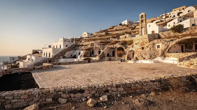
GetYourGuide does not provide a product photo for this activity — the image shows the meeting point, photographed by us.